Barton Rd to Hunts Hall farm and on to the WPC boundary with Dorsington
Path Number – SD32
Distance – 0.96m, 1.55km
Links to footpaths –
Map Location (in red):

Details:
Runs from opposite Headland Road via Hunts Hall lane to the WPC boundary. Can carry on to Dorsington (see map)
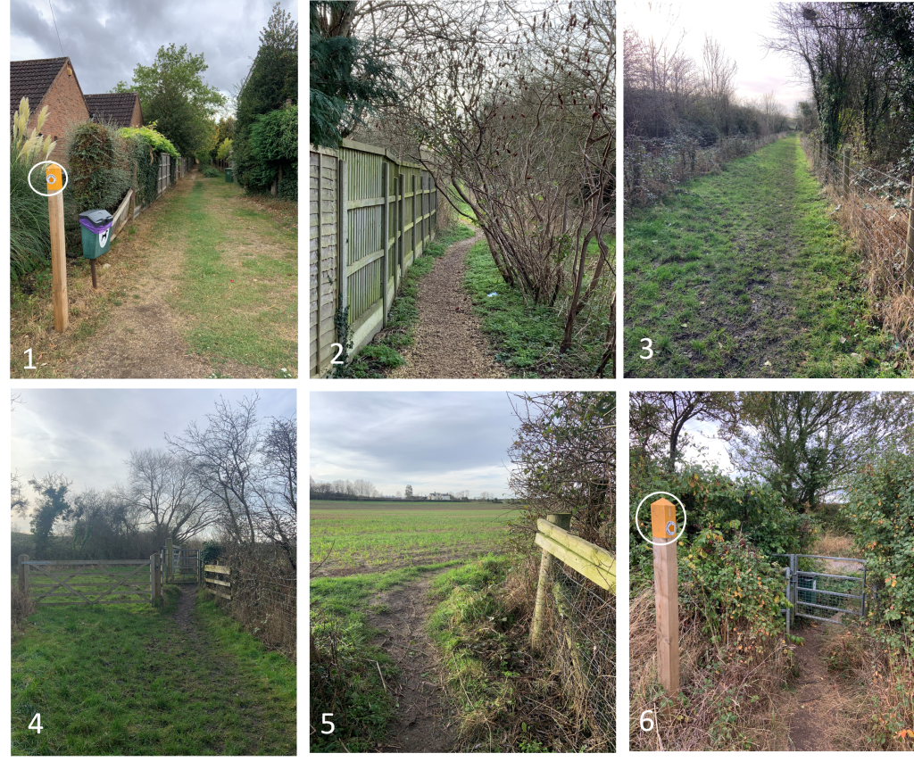
Path starts of in earthen path and then gravel (P1 & P2) then earth again until you meet a swing gate (P3 & P4). The path bends right and follows the edges of a field to the Hunts Hall lane The marker post can be seen in P5 It then crosses a wooden bridge (P6) to the lane. Turn left and follow the lane through the farm until you meet a gate Follow the path across the field (P10 to another kissing gate P11) Pass through this and follow the path until you see the bench (P12)
Start Location (What Three Words) curving.hence.laughs
Mid Location (What Three Words) response.outfitter.professes
End Location (What Three Words) package.belonged.goodbyes
Path quality:
First half of the path is earth and gravel the farmers track to Huns Hall lane which is tarmac. Once through the farm its farmers field tracks and earthen path.
Most of the path can get very muddy in winter. Part of the path is on a residential road
Marker posts:
Well signed marker posts throughout the path (P1, P6, P7, P9 & P10) No marker post at the end
Barriers or obstructions:
Several gates (P4, P6, P7, P9 & P11)
Usage:
Well used in the summer but rarely used in the winter as it gets very muddy
Dog bins:
Dog bin at the entrance opposite Headland Road (P1) and at the entrance to Hunts Hall Lane (P7)
Repairs:
No financially sensible upgrades to the muddy tracks are envisaged