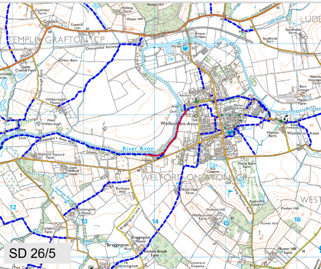
Mill Lane to Cress Hill
Path Number – SD26/5
Distance – 0.52m, 0.84km
Links to footpaths – SD26b/1 (Cress Hill top path) & SD26c/2
Map Location (in red):
Details:
Runs from the Mill Lane to Cress Hill kissing gate
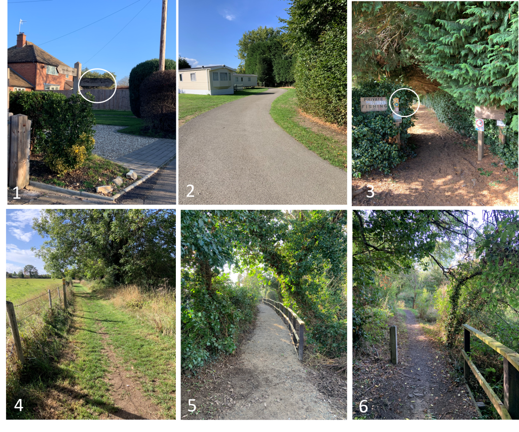
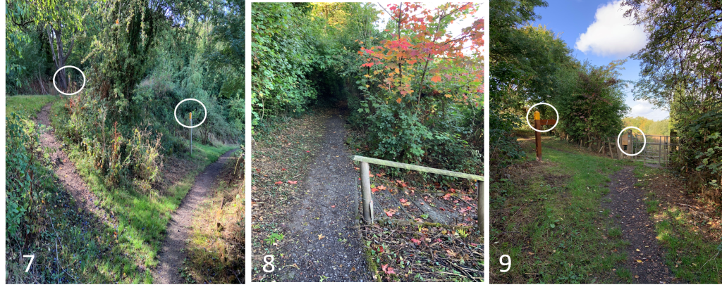
The path starts near the end of Mill Lane at the Avon Path signpost (P1). It then follows a tarmac path through a caravan park and enters a riverside track (P3). It follows a grass track and meets a stone path with handrails (P5) This continues until it enters the Cress Hill area and reverts to a normal stone path (P6) which tracks the river all the way to the kissing gate (P9) There are a couple of spurs to the upper path that takes you to Barton Rd (P7) and a set of steps near the kissing gate which climb to Barton Rd (P9) These spurs are covered in another description. Additionally, there are a couple of sets of steps down to the lower river path used by fishermen (P8)
Start Location (What Three Words) project.recapture.meanest
End Location (What Three Words) duos.shame.thud
Marker posts:
Well signed marker posts at both ends of the path (P1 & P9) and throughout the path (P3 & P7)
Barriers or obstructions:
Kissing gate at the end of the path (P9)
Path quality:
First part of the path is tarmac (P2), then grass track (P4), then well crushed stone (P5) and finally normal crushed stone (P6)
Majority of the path is well away from all main roads. Part usage of residential roads. Grass track can get muddy
Usage:
Well used by walkers and dog walkers
Dog bins:
No bins
Repairs:
Some overhanging branches need removing