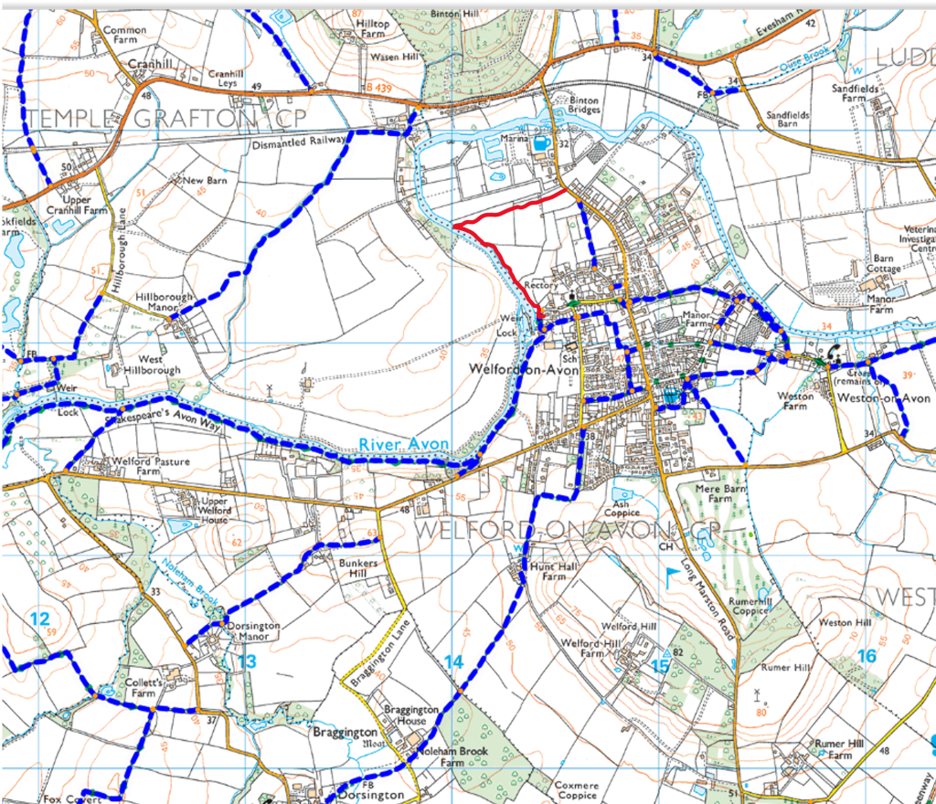
Binton Rd to Boat Lane
Path Number – Permissive path
Distance – 0.56m, 0.9km
Links to footpaths – SD26c
Map Location (in red):
Details:
Permissive path that runs from Binton Rd to the river and then along to Boat Lane
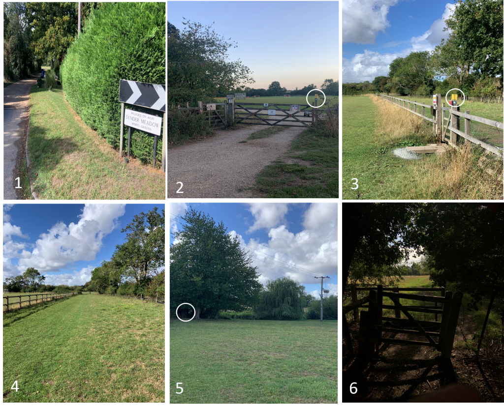
The path starts at the entrance to Synder Meadow on Binton Rd (P1). It then passes through a kissing gate next to the main field entrance gate and crosses diagonally to a swing gate (P3)
The path then follows a grass track (P4) and at the end, bends diagonally towards an electricity pylon where there is another kissing gate (P5 & P6)
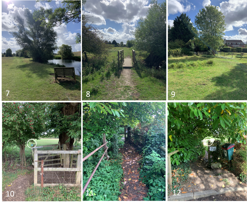
It then tracks the river until arriving at another swing gate at the corner of the field (P9 & P10) There is now a short stone path which comes out on Boat Lane (P11 & P12)
Start Location (What Three Words) haggling.forgets.croak
End Location (What Three Words) notebook.pegs.starters
Path quality:
Mostly hard grass track but can get muddy in the winder. Well away from all main roads.
Marker posts:
Clear marker posts at the beginning and end (P2 & P12) and at several other locations (P3 & P10)
Barriers or obstructions:
Swing gate and farm gate (P2), swing gate (P3) , kissing gate (P6),
wooden bridge (P8) and swing gate (P10)
Usage:
Well used by walkers and dog walkers. Sheep graze at certain time so dogs should be on a lead
Dog bins:
Dog bin near the farmgate (P2) and at the Boat Lane end (P12)
Repairs:
Nothing critical