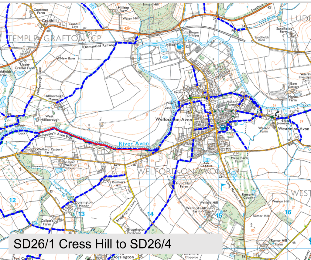
SD26/1 Cress Hill kissing gate to SD26/4
Path Number – SD26/1
Distance – 1.02m, 1.64km
Links to footpaths – SD26/4 & SD26a/1
Map Location (in red):
Details:
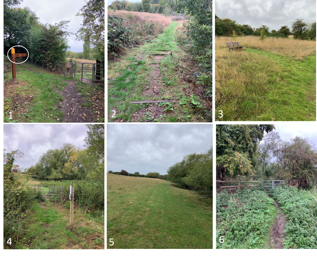
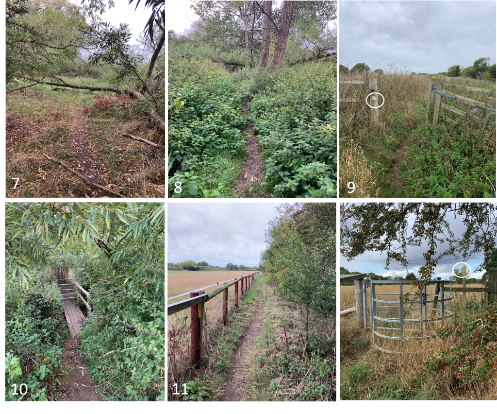
Runs from the kissing gate at the bottom of the steps near Barton Rd to the junction with SD26/4. The path drops down from the gate via a set of steps and then follows the river for some distance through grass fields. It then enters a wooded area where the path gets narrow and overgrown (P6 -P10) before emerging on to a path next to a paddock (P11) before ending at the kissing gate (P12)
Start Location (What Three Words) clusters.flips.firebird
End Location (What Three Words) fairy.hopes.servicing
Path quality:
General condition is good, but the path is narrow in places and sometimes gets overgrown with nettles
Marker posts:
Well signed marker posts at the start (P1), midway (P9) and at the end (P12)
Barriers or obstructions:
Kissing gate at the beginning (P1) Another part way through (P4) Further down is a wooden bridge and gate (P10) and a final kissing gate at the end (P12)
There are several fallen trees that need removing (P7 & P8)
Usage:
Well used by walkers especially in the summer
Dog bins:
No bins
Repairs:
The steps near the beginning of the path need repairing
Several fallen trees need removing
Area with nettles needs cutting back